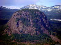
Difference between revisions of "sɫəp̓qs"
Jump to navigation
Jump to search
| Line 1: | Line 1: | ||
{{LO box | 2.75 miles NNE of W end of [http://www.wikipedia.com/wiki/Lake_Cavanaugh,_Washington Lake Cavanaugh] | GPS1 = 48°19′33″N | GPS2 = 122°1′13″W}} | {{LO box | 2.75 miles NNE of W end of [http://www.wikipedia.com/wiki/Lake_Cavanaugh,_Washington Lake Cavanaugh] | GPS1 = 48°19′33″N | GPS2 = 122°1′13″W}} | ||
{{DN}}sɫəp̓qs | {{DN}}sɫəp̓qs | ||
{{PR}} sɫə́p̓qs <br> | {{PR}} sɫə́p̓qs <br> | ||
Revision as of 01:27, 23 February 2016
| Location: | 2.75 miles NNE of W end of Lake Cavanaugh | |
| Google Maps: | 48°19′33″N 122°1′13″W |
Template:DNsɫəp̓qs
pronunciation: sɫə́p̓qs
word analysis: : s- (nominalizer) + ɫəp̓ (hang over ) + -qs (nose, point)
Number of times this entry has been verified against the sources, including at the time of creation: 1
In general, an entry with a higher number of verifications and sources may be considered more reliable.
sources
- 2004, William Bright, Native American Placenames of the United States, ISBN 0-8061-3576-X, University of Oklahoma Press, p. 454
